hiking
road trips
national parks
washington
oregon
travel
categories
keep up with
the latest!
My name is Shirin and I am an Iranian American living in the Pacific Northwest. Welcome to my journal where I share my travels throughout the PNW and beyond!
You will find travel itineraries, PNW bucket list hikes, and PNW weekend getaways, road trip ideas, and more! My aim is provide travel options for the working professional living in the Pacific Northwest to take advantage of your free time and get out in this big wide world!
I'm Shirin
HELLO!
Washington Bucket List Of Day Hikes
February 17, 2022
I remember when I first started hiking I was so overwhelmed by the amount of hiking options within the Pacific Northwest. To avoid that frustration for you, I have created a checklist of my Washington bucket list of day hikes so you can have an accessible handout!
Now, let me remind you that Washington is one of my FAVORITE states to hike so the below list a general list containing hikes in various areas within Washington. Additionally, I have a separate blog post regarding my favorite hikes within Mount Baker region area specifically here, as that is my favorite area to hike. Lastly, I have tried my hardest to keep the Washington Bucketlist of Day Hikes to be within a 2.5 hour drive from Seattle, however, there are MANY beautiful hikes on the Washington gorge side or over 3 hours away such as Beacon Rock trailhead, Silver Star mountain, Spirit Falls, and Walupt lake. I wanted to keep this list to under 20 hikes so it was hard to pick and choose!
Below you will find my Washington bucket list of day hikes, in no specific order!
Park Butte Lookout
Distance from Seattle: 2:15 minutes
Hiking Distance: 7.2 miles | Elevation Gain: 2,000 | Rating: Moderate
There are many fire lookout hikes within Washington state. Park butte however, is one of my favorites. This hike takes you to a unique lookout with panoramic views of the North Cascades. Right before getting to the lookout, you will need to climb a ladder, so be weary if you bring dogs!
Gothic Basin and Foggy Lake
Distance from Seattle: 2 hours
Hiking Distance: 12.5 miles | Elevation Gain: 3,300 | Rating: Difficult
This is one of my FAVORITE hikes! This hike can be quite deceiving because the first 2 miles is relatively flat and a simple walk in the woods, and then you gain all the elevation in the last 3-5 miles through switchbacks and rock scrambling. Some parts are trickier to navigate, but you won’t lose track of the trail if you just keep going up! With a regular daypack on, the hike up can take about 3.5 hours, with an overnight pack, this hike could be a bit more brutal at about 5 hours. Once you are up at the basin, there are multiple ways to go- you head right up and right towards Foggy Lake, or up and left towards Granite Mountain, or you can just enjoy the basin!
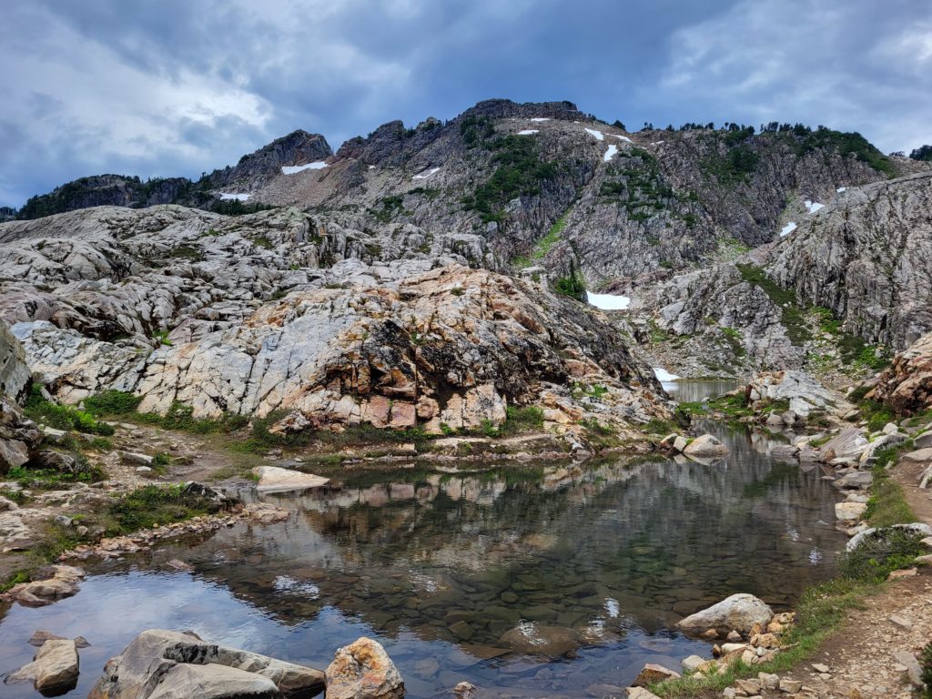
Heliotrope Ridge
Distance from Seattle: 2 hours
Hiking Distance: 5.6 miles | Elevation Gain: 2,000 | Rating: Difficult
The road leading to the trailhead is closed until an anticipated date of January 2023. In the meantime, you are able to park before the cement blocks. Here, at the washout you can walk or bike to the trailhead, adding an extra 4.5 miles, each way. By bike, this will add about 1.5 hours there and 30 minutes back and is harder than the hike itself. You could also walk the road and make this trip an overnighter! The hike itself will lead you nose to nose to one of Baker’s beautiful glaciers, Coleman Glacier. This is also often the climbing route for Mount Baker. You will often see this well-traveled with many established campsites along the way. Depending on the season, you may pass multiple knee-deep creeks in which you should proceed with caution. To top off the day, on the way back stop by North Fork Brewery!
Colchuck Lake
Distance from Seattle: 2 hours
Hiking Distance: 8 miles | Elevation Gain: 2,300 | Rating: Moderate
I am sure every Seattleite knows about this- heck, I sometimes feel like everyone in the world knows about this. Do yourself a favor and try to steer clear of this place on a Saturday in Summer. IF you have to, then be prepared! People from all over come for this magnificent hike. It is relatively moderate and straight forward, meaning no real technical skills needed (unless going off season). This hike is part of the Enchantments, a world-famous backpacking trip many have heard of. If you are lucky enough, I highly suggest applying for a permit or setting out some time and trying to get an in-person permit! An additional reminder that this hike is NOT dog friendly, so leave your dogs at home!
Minotaur Lake
Distance from Seattle: 1.5 hours
Hiking Distance: 3.7 miles | Elevation Gain: 2,600 | Rating: Difficult
Another great lake hike that I consider a competitor to Colchuck, is Minotaur. Many people do not know about this hike so you will find it much quieter than Colchuck, but just as beautiful. You will find a beautiful lake at the end of your hike for a shorter distance, but more elevation gain per mile!
Winchester Lookout
Distance from Seattle: 2.5 hours
Hiking Distance: 3.3 miles | Elevation Gain: 1,340 | Rating: Moderate (with access to driving trail being difficult)
First and most importantly, this hike is NOT recommended for anyone not in a 4×4 high clearance vehicle. The alternative would be to park in the Yellow Aster Butte Parking lot and walk the extra 3 miles up the trailhead. This hike/trail is the best bang for your buck as there is minimal hiking leading to the BEST view, the only downfall is the access to the trailhead.
Hidden Lake Lookout
Distance from Seattle: 2:15 minutes
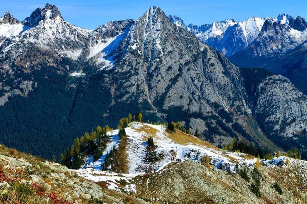
Hiking Distance: 8.5 miles | Elevation Gain: 3,600 | Rating: Difficult
This trail offers the ultimate Washington view leading to above tree line, but is longer than AllTrails states! The road to get there is rough and you will need a high clearance vehicle and can take at least 30 minutes. The drive up will need experience and confidence in driving a scary road, but there are several pull out points and not heavily exposed, which is nice. I was able to make it in my Hyundai Santa Fe, but was thankful not many cars came against me. AllTrails and WTA state this is a 7.5-mile hike, but when I have recorded this it is around 8.5-9 miles. On this hike you will pass multiple stream crossings, wildflowers, granite slab, and it is a steep and constant incline on the way up.
Tolmie Peak
Distance from Seattle: 2 hours
Hiking Distance: 7.5 miles | Elevation Gain: 1,100 | Rating: Easy
First, you unfortunately will need to leave your dogs at home, nor are you able to backpack this hike. Along this hike you will see views of Mount Rainier and a lookout at the end. Expect for the hike to take an average of 3-3.5 hours to complete. Often times people picnic at the end, as the elevation gain is not too bad for extra weight! The trail begins at the north side of Mowich lake. The trail gradually goes down and then a steep uphill towards Eunice Lake, and then the last mile to the lookout peak.
Lake Ingalls
Distance from Seattle: 2.5 hours
Hiking Distance: 9.5 miles | Elevation Gain: 3,150 | Rating: Moderate
First, you unfortunately will need to leave your dogs at home. Dogs are NOT allowed on this trail to maintain the wildlife on this trail. This can be considered a day hike, or you can make it into a backpacking trip if you have the time. To backpack, you will hike down into Headlight Basin for the camping spots. At the end of the trail you will see a stunning blue lake, surrounded by rocky peaks. A beautiful backdrop of Mount Stuart in the background. The trail up to Ingalls Pass is straightforward, with just two junctions for Esmeralda Basin and Longs Pass. Expect the trail to start off relatively steep, then level out as you go farther in a bit before getting steeper again. It gets pretty rocky in areas as you climb, so I would suggest some hiking boots or shoes with traction.
Mount Townsend
Distance from Seattle: 2 hours
Hiking Distance: 8.5 miles | Elevation Gain: 3,000 | Rating: Difficult
*Of note: There are multiple different trails to the top, with each route differing in distance and elevation gain. Additionally, depending on the route you are taking from Seattle, you may need to take a ferry!
This is your perfect year-round hike. You can see wildflowers early in the season, fall colors in the autumn, and panoramic views in the summer! The trail is a pretty constant steady uphill, but at the top you are often rewarded with views of Baker, Rainier, Adams, Shuksan and St. Helens.
Mount Ellinor
Distance from Seattle: 2.5 hours
Hiking Distance: 6.2 miles | Elevation Gain: 3,350 | Rating: Difficult
There are two ways you can start this trail: the lower trailhead and the upper trails. To park at the upper trailhead you will need a Northwest Forest Pass, however, this pass is not needed to park at the lower trailhead. If you choose to park at the lower trailhead, your hike will be 6.2 miles round trip, from the upper trailhead your hike will be 3.2 miles. Though the hike will be shorter from the upper trailhead, you will be gaining almost 2,500 feet of elevation in less than 2 miles, so prepare for it to be STEEEEP!
Burroughs Hike Mount Rainier
Distance from Seattle: 2.5 hours
Hiking Distance: 6.3 miles | Elevation Gain: 1,600 | Rating: Moderate
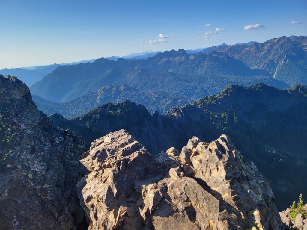
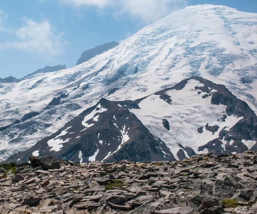
As this hike is in a national park, leave your animals at home! This is my most suggested hike when someone is trying to people familiar with Mount Rainier. When at the top, you will feel like you can summit! This trail is relatively gradual incline and fairly rocky the entire time. Be prepared to also be exposed and minimal water sources available, so make sure to have lots of water and sunscreen on hand! The start of the trail leads to many different trails so continue to follow the signs for Burroughs!
Snow Lake
Distance from Seattle: 50 minutes
Hiking Distance: 6.6 miles | Elevation Gain: 1,830 | Rating: Moderate
This is generally everyone’s first lake hike that keeps Seattleites coming back for more, and generally my first recommendation for someone wanting to experience a bit more. The trail starts from the Snoqualmie Pass Alpental ski area. Once at the end of the hike, you will have to go down just a bit to access the actual lake. This hike has everything you want and more! Beautiful views DURING the hike and leading to a glacier filled lake to swim in the summer! I find that many hikes tend to be forested and not having great views, however halfway into this hike you will find yourself surrounding by views of jagged rocks and mountains. If you choose to make this a backpacking trip, you can continue to follow the eastern edge of the trail and push another 2 miles and 900 feet to get to Gem Lake!
Blanca Lake
Distance from Seattle: 2:15 minutes
Hiking Distance: 8.5 miles | Elevation Gain: 3,500 | Rating: Difficult
The road to the trailhead is not too difficult and can be done with any car, however, every time I have done this trail I have either experienced large potholes or downed trees. The trail starts in the forest and you will receive a fair amount of shade early on. You will climb about 3,000 ft in 3 miles, so this hike is not meant for beginners. You will experience switchbacks, rocky areas, huckleberry bushes, and steep elevation, leading to an unwordly blue-green colored lake!
Chain Lakes Loop
Distance from Seattle: 1.5 hours
Hiking Distance: 7.5 miles | Elevation Gain: 1,800 | Rating: Moderate
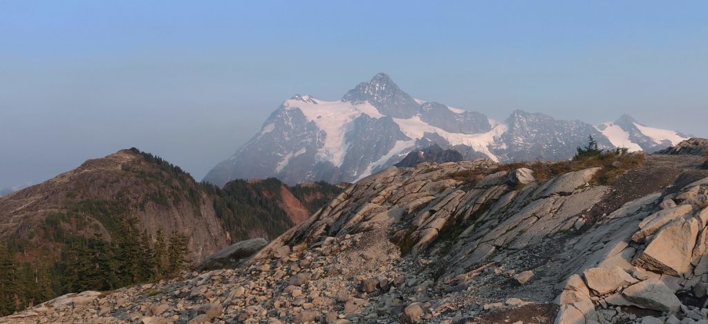
Yes, this hike is long, but boy oh boy are these views magnificent. Chain Lakes is a CLASSIC Northwest hike! You will feel like you are in a wonderland every step of the way. Trail is relatively easy to navigate and bonus points, there are some backpacking spots part way in by the lake! Along the way you will see a panoramic view of the North Cascades, a few alpine lakes for swimming/backpacking, and numerous grassy meadows!
Heather – Maple Pass Loop
Distance from Seattle: 2:45 minutes
Hiking Distance: 6.6 miles | Elevation Gain: 2,100 | Rating: Moderate
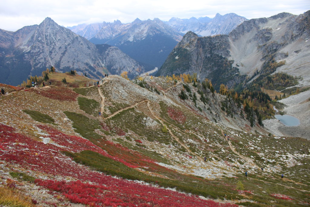
Hands down, one of my top 5 favorite hikes within Washington. You literally feel like you can summit every peak and feel out of this world! The jagged rocks and panoramic views will want you to achieve more and become a mountaineer or climber! I highly suggest for it to be done in October to see some larches!
Lake 22
Distance from Seattle: 1.5 hours
Hiking Distance: 5.7 miles | Elevation Gain: 1,460 | Rating: Moderate
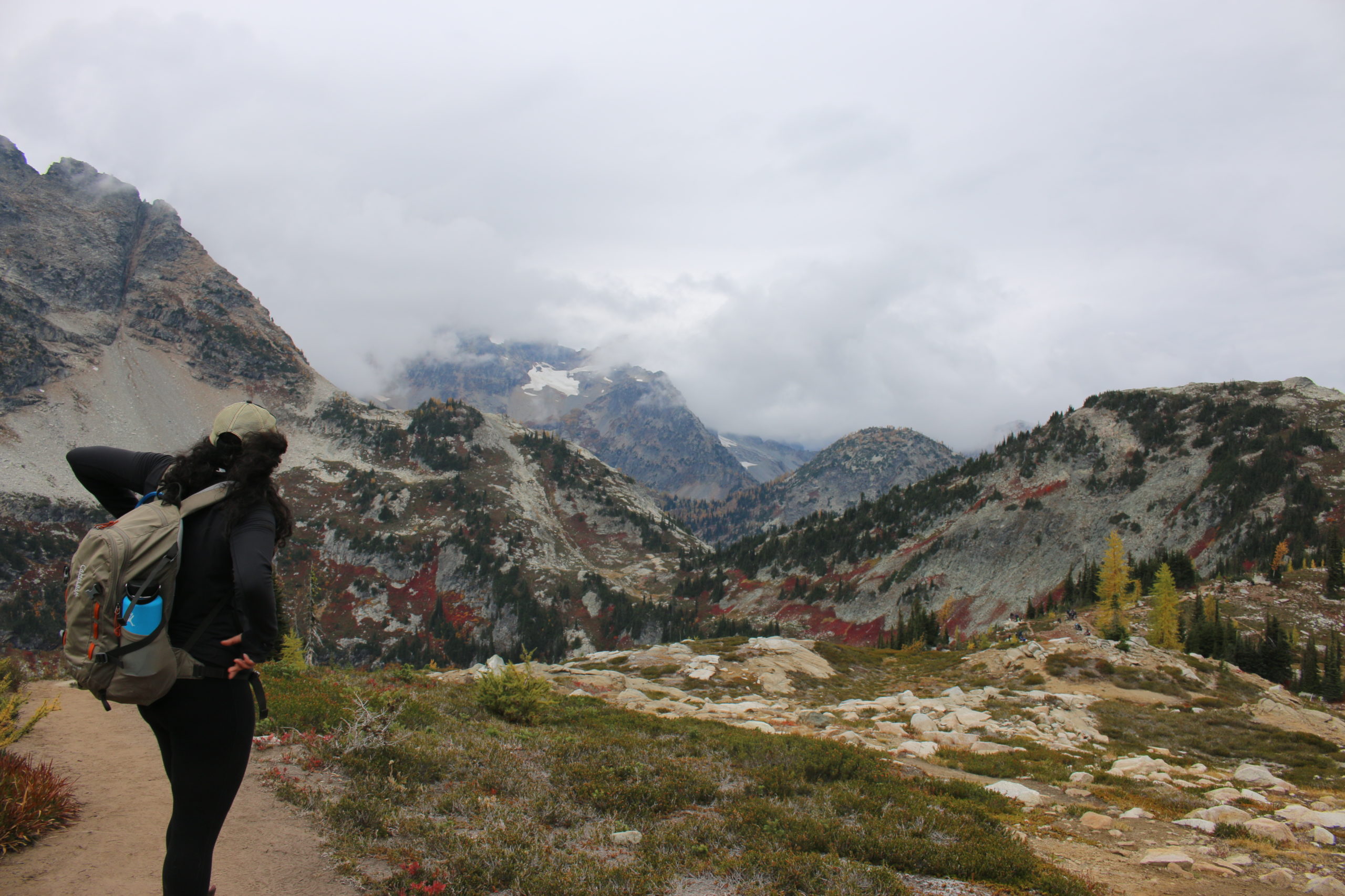
This is your best “bang for buck” type of deal as this is a shorter hike that leads to an EPIC view! This hike is absolutely wonderful in winter and summer. On a hot summer day, you will find people soaking in the views and some UV rays. The trail is easy to follow and has a picturesque bridge at the end.
Pete Lake
Distance from Seattle: 2.5 hours
Hiking Distance: 9.0 miles | Elevation Gain: 400 | Rating: Easy
Make sure you have the map downloaded ahead of time or a printed map to figure out where you are going, as you will not have service for the last 40 minutes. Pete lake makes for a great day hike OR overnighter. To make this hike more fabulous you can do an overnighter to Spectacle lake and stop by the Roslyn farmer’s market on a Sunday coming back! On the way back from Pete or Spectacle lake, you will also want to have your inflatable paddleboard so you can swim in Cooper Lake! Along Cooper Lake there is also a ton of dispersed camping where you can camp for free along the lake, or you can pay just a little and camp at the designated Owhi Campground.
PooPoo Point
Distance from Seattle: 30 minutes
Hiking Distance: 6.6 miles | Elevation Gain: 1,700 | Rating: Moderate
This fabulous hike has to take one of the top 20 spots as this is an accessible year-round hike, close to the city and more doable for most age levels. With enough elevation gain, you will feel your heart pumping early on. For people living within an hour away, this is a nice hike to do after work, catch a sunset, and hike back with your headlight! This trail is short enough to do after or before work, and also can be challenging enough for people wanting to try their new gear or train by weighing their packs heavy. Also, once you reach the top, you will see paragliders! From the moment they unpack their gear to the moment they step foot off the cliff, you will not believe your eyes!
Yellow Aster Butte
Distance from Seattle: 2.5 hours
Hiking Distance: 7.10 miles | Elevation Gain: 2,677 | Rating: Moderate
This hike is best completed in the fall time, where autumn larches are at an all-time high. My suggested month would be October, but really any time of the year (other than Winter) would be a great time! The gravel path to the trailhead is not for the faint of heart. It is suggested that an experienced driver take the wheel as the road can be narrow with little pull out sections for cars returning.
Finally, like what you read? Check my travel blog for more!
Be the first to comment